
By the time a new subdivision shows up on a map, it may already be too late. The best land deals don't start with a listing — they start with a zoning change. A county quietly rezones a 200-acre parcel from Agricultural to Residential. A municipality approves a density increase. A single classification shift signals that a market is about to move, and a new competitor is about to break ground down the street.
Until now, catching those signals meant manually checking county GIS portals, tracking municipality meetings, and hoping you found it before someone else did. Two new features inside Locate Alpha — Zoning Timeline and Rezoning History — change how early you can see deals and competitors coming.
A land analyst's workflow
Start broad, then drill down.
Open Rezoning History as your early-warning scan across an entire market. Set a date window — last month, last quarter, last six months — and filter by the kind of change that matters to your strategy: category shifts like Agriculture to Residential or Single Family to Multifamily, zoning-code changes like R-1 to R-5 signaling added density, or changes to allowable uses. Every qualifying parcel maps instantly. If something moves in a submarket you're watching, you see it the same month it happens, not six months later when ground breaks.
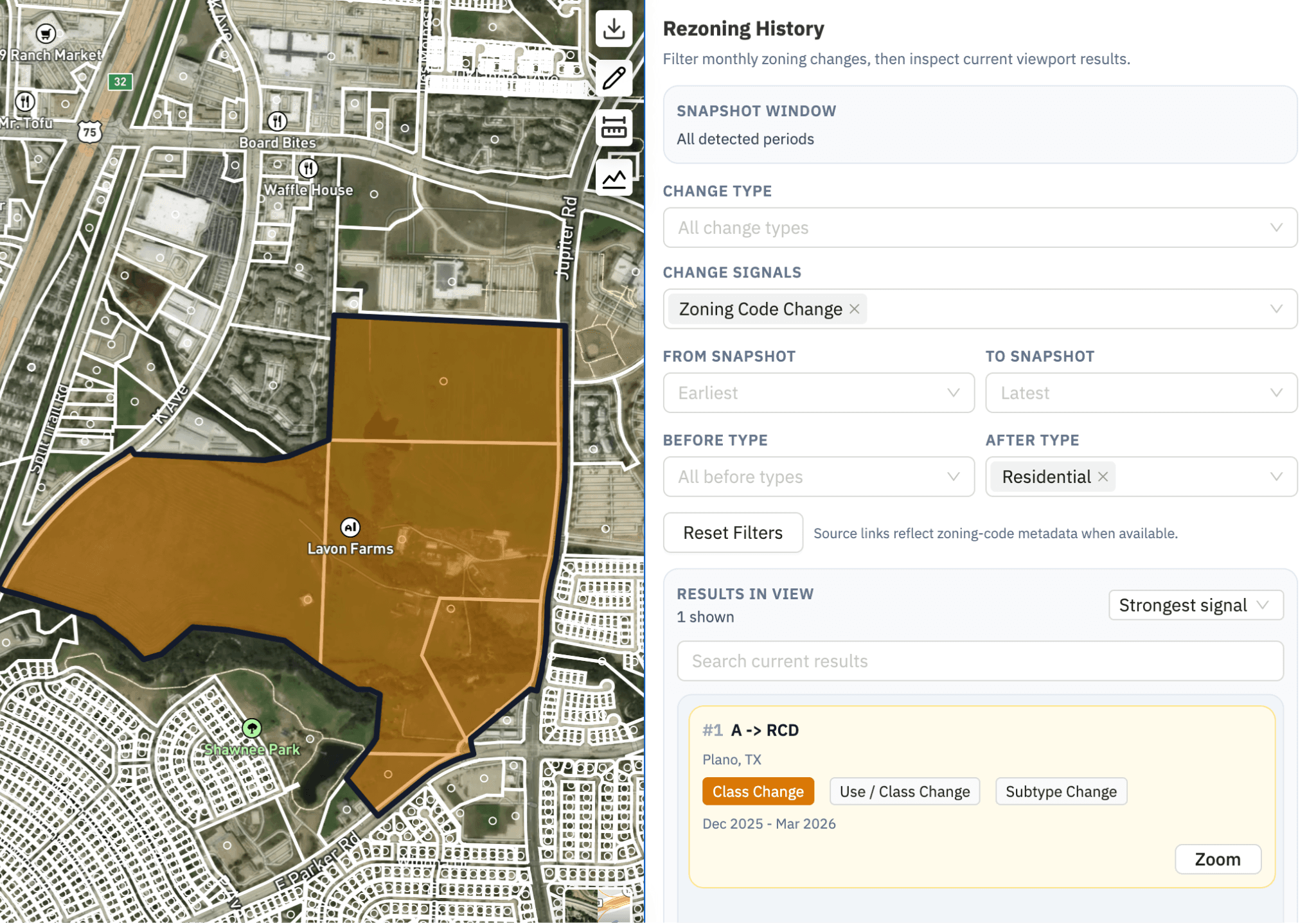
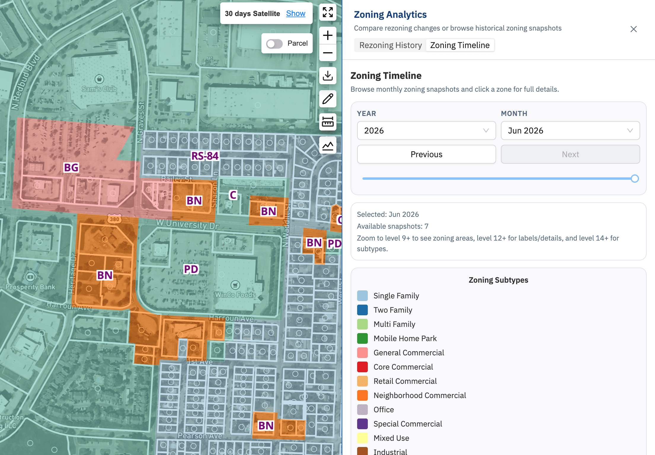
When a parcel catches your eye, switch to Zoning Timeline to read its full classification history. This is where you separate signal from noise. Was this site always Residential, or did it just convert from Agricultural? Recent reclassifications are your strongest leads; long-standing zoning is context. Full code names are shown in plain language — RTO reads as Residential Transition Overlay — so you can interpret a parcel without a side trip to the county code book.
For day-to-day parcel research, you don't have to leave your usual view. The main parcel breakdown now surfaces a Recent Zoning Changes summary, with a link into the full analytics when you want the complete picture. Single-parcel checks stay fast; deep dives stay one click away.
Turn signals into action
Export a parcel's recent changes to CSV for your own underwriting models, to PDF for a clean record to share with your team, or to Markdown to drop straight into an AI assistant like Claude for rapid summarization and next-step analysis. The goal is to move from "something changed here" to a prioritized outreach list in minutes.
A practical cadence: run a same-market scan at the start of each month, flag every category and density change, check each flagged parcel's timeline to confirm it's a genuine shift, and export the survivors. Underlying data refreshes monthly, so a monthly rhythm keeps you consistently ahead.
Used together, these features tell you not just where zoning has changed, but what that change means in context — the earliest possible signal on where development is headed next.
Already a user? Sign in to try Zoning Timeline and Rezoning History today.
