
Boosting growth near Downtown

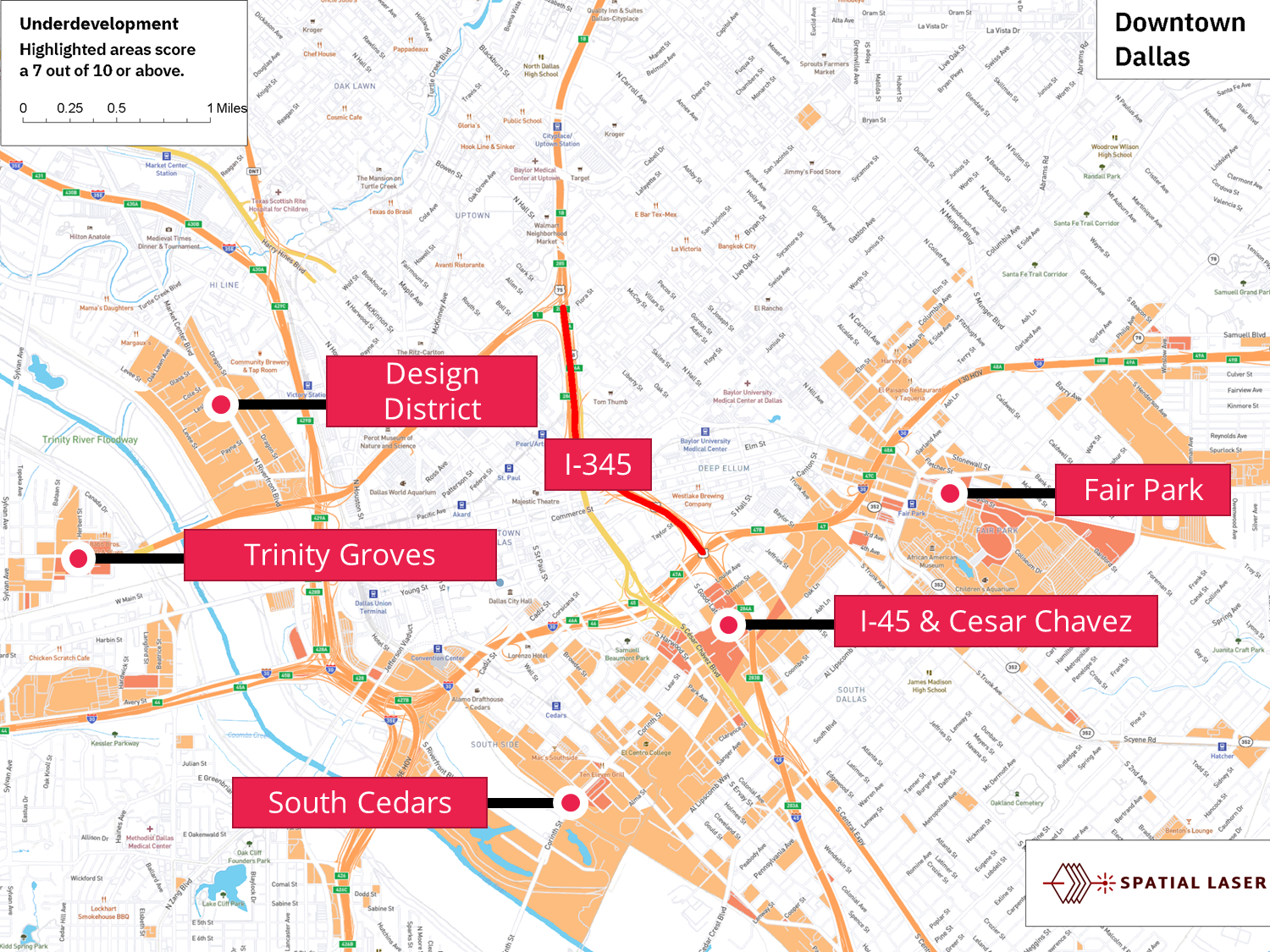
For the last several years, we have been following the planning of the I-345 corridor re-development near downtown Dallas. The idea, which has been studied since 2014, revolves around dismantling a freeway that has bisected the city since the early 1970s and contributed to under-performance in nearby areas. I-345 is highlighted in red below, with underperforming blocks filled in with orange.
If redevelopment takes off, these areas are poised to benefit from a substantial uptick in property values.

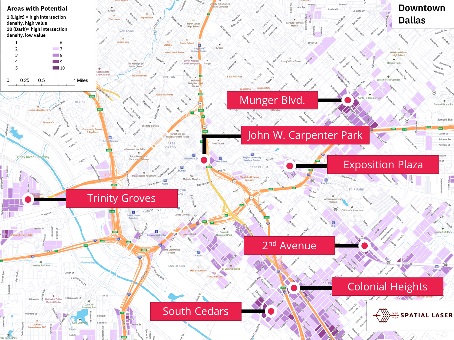
Also, these are the areas where high density of intersections and low value of existing buildings suggest development potential as well:
In a conversation with Patrick Kennedy, one of the masterminds and proponents of the initiative, I thought about whether there is an obvious way to calculate which specific areas are most affected by under-development and are best placed for revival if the I-345 freeway is dismantled. In the rest of this article, I will walk you through the process.
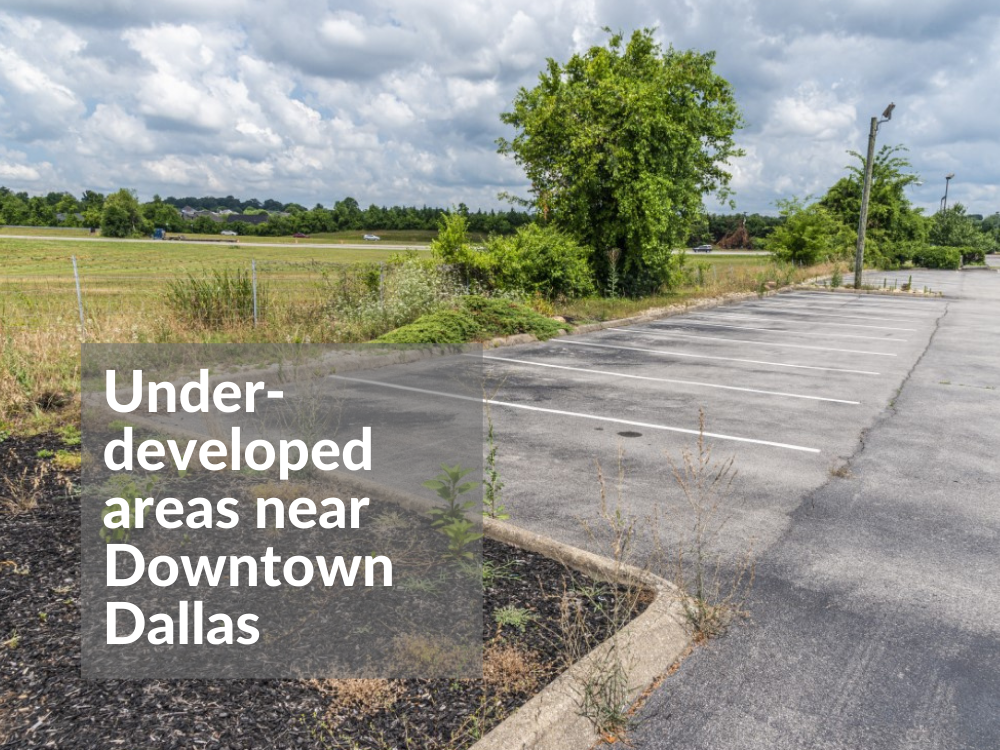
What do underdeveloped areas look like?
Underdeveloped areas are typified by empty lots, paved (or unpaved) parking lots, disused or lightly used industrial facilities, limited habitation, and limited commercial structures or activity.

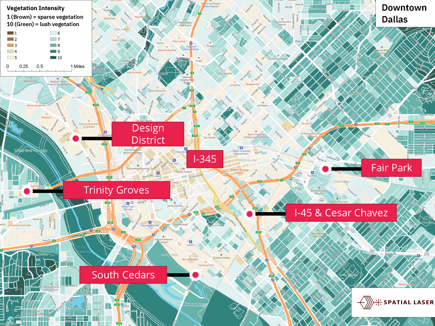
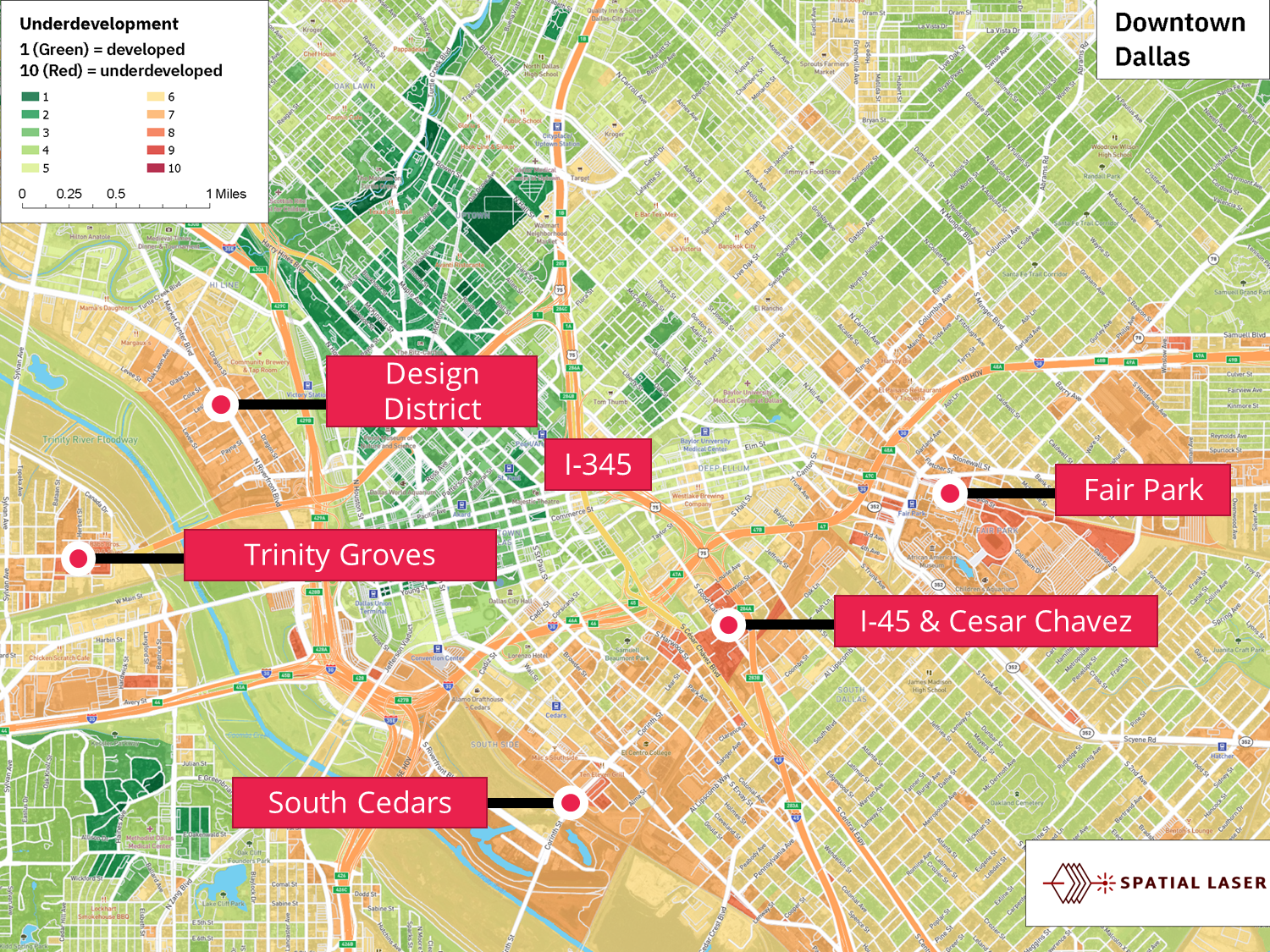
First, we believed that underdeveloped areas near downtown tend to be rather sparse with trees, bushes, and shrubs. In these areas, landscaping is rare, and the land is often paved over with concrete or asphalt and may serve as a temporary parking lot. To identify underdevelopment, we turned to images from satellites that orbit the earth. We used the industry-standard vegetation index known as the NDVI*, which measures vegetation intensity at a 10-meter resolution.
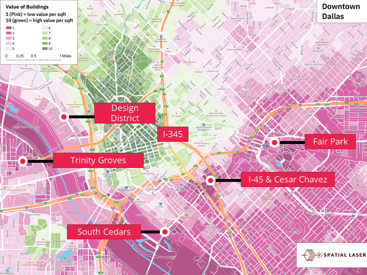
Low property values
Not only should an “under-developed” area be light on vegetation, the area should also have low property values. The land might be worth a significant amount, but with few buildings constructed on it, the land is considered to be under-improved. To measure this, we looked at the 2020 tax-assessed values of improvements near each city block, on a per square foot basis.
Combining the two
In order to find areas that have both low building value and low vegetation, we combine the two measures. We end up with several areas appearing in bright red-orange:
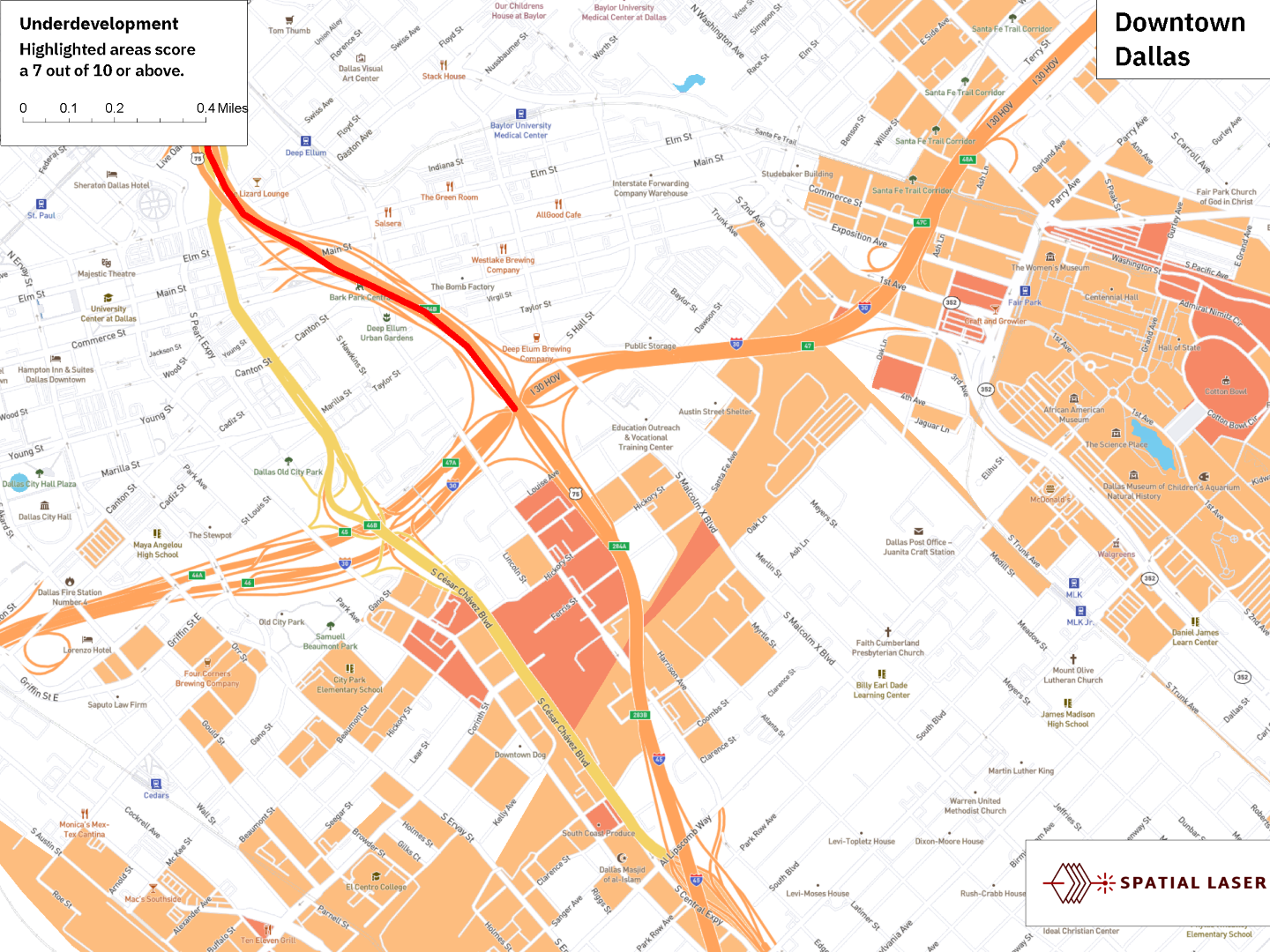
Removing the green areas to highlight the underdeveloped areas only, several areas appear:
- Areas between S Harwood Street and I-45.
- Areas along Corinth Street
- Areas between Haskell Avenue and Carroll Avenue, near I-30
The under-developed areas identified by the Locate Alpha team tend to overlap well with those targeted in redevelopment proposals such as the Toole IH345 framework plan. Fair Park can be ignored as it is a public destination and low property values are not relevant.
What does it mean for investors?
These will be key areas to watch. If redevelopment takes off, these will be areas to get in early before property values take off.
Walkable areas missed by the market
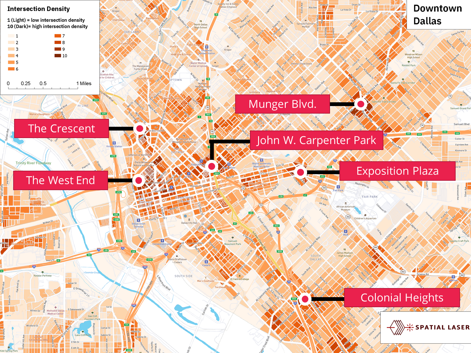
Another way of thinking about the potential for higher and better use is to look at the density of road intersections. These typically promote greater activation of an area by slowing down traffic and making an area walkable. We calculated this by excluding freeways and focusing only on surface streets and frontage roads. Several areas light up as being particularly dense with intersections:
- The “bend” in I-345 at John W. Carpenter Park, just south of the Pearl / Arts District DART station. This is interesting because it is where the angle of the street grid changes. It is also an area that is relatively under-built.
- The West End. This makes sense because it is an old historic area.
- The area around the Crescent in Uptown, where many streets converge.
- The areas around Munger Blvd. where the East Side begins
- Exposition Avenue on the western edge of Deep Ellum
- Colonial Heights along the S.M. Wright Freeway (310)
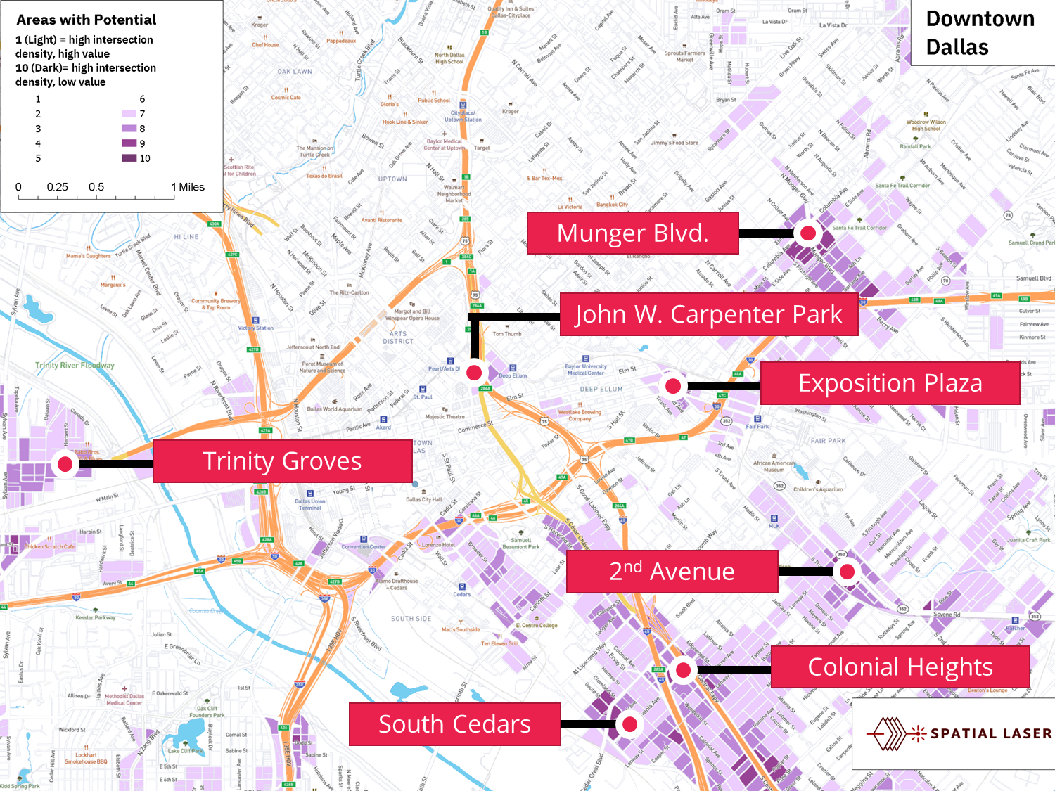
If we combine areas with high intersection density with areas of low improvement value, we get the following. Some of the same areas light up.
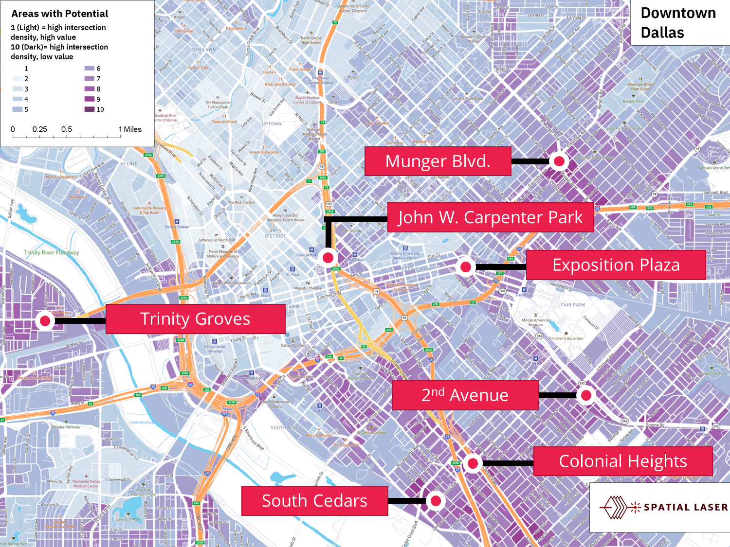
By keeping only the areas the aeras with the “highest” intersection density coupled with “lowest” improvement value, we are left with:
- Munger Blvd, once again
- A small section around the John W. Carpenter Park by I-345
- 2nd avenue southeast of Fair Park
- Large areas along 45 and 310
- Trinity Groves
Concluding remarks
All of these are areas where the density of the road network suggest the potential for much greater levels of development than what exists today.


